Wind turbine monitoring
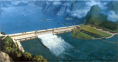
Reservoir dam monitoring
- inexpensive
- Automatic report generation and delivery
- Early Warning Information Text Messages
- Personalization
- One-stop service for system integration and high-end service platforms
 System Advantages

Information sharing/automated real-time monitoring
Information sharing data in accordance with the unified norms and standards, the use of multi-dimensional heterogeneous data fusion technology, wind data to achieve a map integration; construction of continuous 24-hour uninterrupted measurements, precision mm level monitoring

Integrated risk monitoring
Comprehensive collection of wind turbine safety production risk element data, and three-dimensional tilt photography modeling of the wind turbine and the surrounding area, to achieve the wind turbine three-dimensional dynamic integrated monitoring and display

Risk Precision Early Warning
Detect weather conditions in advance, according to the set warning thresholds, deformation rate analysis, automatic warning alerts, and through the relevant algorithms will be the early warning information actively pushed to the person in charge by SMS, email

Cross-system compatible data push
Compatible with the old system, the wind turbine displacement track, blade headroom distance, video images and other information of the data resources integration, access to the existing platform for data push, to achieve the wind turbine standardization, information technology, modern management
 Monitoring elements

- Monitoring Principles
This system adopts BeiDou automated monitoring method to monitor the surface displacement of the monitoring area for automated deformation monitoring, and its working principle is as follows: each BeiDou monitoring point and reference point receiver receives BeiDou signals in real time and sends them to the control center in real time through the data communication network, and the BeiDou data processing software of the server of the control center decodes the three-dimensional coordinates of each monitoring point, and the data analysis module acquires the three-dimensional coordinates of each monitoring point and compares them with the initial coordinates to obtain the amount of change of the monitoring point. The data analysis module acquires the three-dimensional coordinates of each monitoring point and compares them with the initial coordinates to obtain the amount of change of the monitoring point, and at the same time, the analysis software alarms according to the pre-set warning value.
- Monitoring equipment
The technical parameters are as follows:
- Observed parameters BDS B1, B2
gps l1 c/a, l2 e, l2 c, l5
GLONASS L1 C/A, L2 C/A - positioning accuracy
Level 2.5mm+1ppm RMS
Vertical 5mm+1ppm RMS - Environmental parameters Positioning time Cold start<45S
Hot start 30S Initialization reliability >99.9% - Operating temperature -40˚C to +75˚C Recapture time <2S
Supply voltage 9 to 36 (V) DC Storage temperature -55˚C to +85˚C - Mechanical shock MIL810D, ±40g Baud rate 2400 to 460800
Humidity 99% non-condensing Power consumption <3.5W
- Observed parameters BDS B1, B2
- Monitoring Principles
Inclinometer is suitable for long-term installation in concrete dams, panel dams, earth and stone dams and other hydraulic buildings, and industrial and civil buildings, roads, bridges, tunnels, roadbeds, civil pits and other measurements of the amount of change in its tilt, easy to realize the automation of the collection of measurement data.
- Monitoring equipment
The technical parameters are as follows:
- Range: ±15°, ±30°, ±60° (optional according to the actual situation)
- Sensitivity: ≤9″
- Measurement accuracy: ≤0.05%F.S
- Signal output: RS485
- Working temperature: -30~+72℃
- Monitoring Principles
Mainly consists of a pole, wind vane, wind cup, wind speed and wind direction sensor, the wind vane pointing that is the direction of the wind, according to the wind cup speed to calculate the wind speed.
- Monitoring equipment
The technical parameters are as follows:
- Measuring range:0-45m/s 0-70m/s
- Accuracy: St (0.3+0.03V) m/s
- Resolution:0.1m/s
- Start-up wind speed:<0.5m/s
- Power supply mode:DC5V/DC12V/DC24V
- Output signal: pulse signal Current (4-20mA)
- Monitoring Principles
Stress gauge (stress gauge) is an instrument to measure the ground stress. According to the ground stress measurement in the sensor used in different stiffness, the sensor can be divided into two kinds: if the stiffness than the measured location of the rock's stiffness, known as the stress gauge; if less than the measured area of the rock's stiffness, it is called deformation gauge or strain gauge. Because the stress gauge stiffness, has a great ability to resist the deformation of the rock, and the pressure itself depends mainly on the stress in the rock, and the elastic constants of the rock has little relationship, the greater the stiffness of this effect is more pronounced, and therefore it is not necessary to accurately determine the elastic constants of the rock when measuring.
- Monitoring equipment
The technical parameters are as follows:
- Standard range: 400Mpa
- Nonlinearity: ≤0.5%F.S.
- Sensitivity: ±1mm-±25%F.S
- Endurance: 24 hours of uninterrupted monitoring
- Communication capability: based on 4G/5G communication, data transmission delay is less than 10ms
The technical parameters are as follows:
- Standard range: ±1500με
- Measuring standard: 150mm
- Sensitivity: 1με (1Hz)
- Working Temperature: -10℃~70℃
- Communication capability: based on 4G/5G communication, data transmission delay is less than 10ms
- Monitoring Principles
Cameras are deployed in important areas such as the upstream water feet of each reservoir. With the help of video AI technology, it realizes flood discharge monitoring, reservoir water level monitoring, and reservoir engineering management. Based on artificial intelligence image recognition technology, through deep learning algorithms, it automatically extracts, locates and analyzes specific scenes and behaviors appearing in the video monitoring, automatically identifies the scenes and illegal and unauthorized contents in the front-end video streaming data, such as trespassing by illegal people, illegal swimming, etc., and timely carries out intelligent early warning, remediation instructions are automatically sent by outbound call, so as to improve the efficiency of manual supervision and costs. Adopting cloud inspection method to seamlessly connect with the existing artificial intelligent inspection to improve and enhance the traditional manual inspection work mode.
- Monitoring equipment
The technical parameters are as follows.
- Minimum illumination: Color: 005 Lux @ (F1.5, AGC ON), B/W: 0.001 Lux @ (F1.5, AGC ON), 0 lux with IR
- Focal length: 5.9~-177 mm; 30X optical zoom
- Field of view: 57.4°~2.3° (wide-angle~telephoto)
- Infrared irradiation distance: 150 m
- Horizontal range: Horizontal 360° Vertical range: -15°~90° (auto flip)
- Horizontal speed: Horizontal keying speed: 1°~160°/s, speed settable; Horizontal preset point speed: 240°/s Vertical speed: Vertical keying speed: 1°~120°/s, speed settable; Vertical preset point speed: 200°/s
- Main stream frame rate resolution: 50 Hz: 25 fps (2560 × 1440); 60 Hz: 24 fps (2560 × 1440)
- Video Compression Standard: H.265, 264, MJPEG
- Network Storage: NAS (NFS, SMB/CIFS)
- Network interface: RJ45 network port, adaptive 10 M/100 M network data
Working Principle
Early warning broadcasting equipment is based on 4G public network, providing users with multi-functional wireless early warning broadcasting services. High-fidelity power amplifier: strong, clear and bright sound quality, strong directivity, wide spread, even in a vast area, many obstacles in the environment, is still clear spread
- Real-time, timed, and periodic notification shouts
- Mobile APP, 4G microphone emergency remote shouting
- Automatic shouting for intruder sensing
- Short message alarms, voice alarms, local microphone shouting alarms
 system platform

Monitoring Principles
Rainfall automated monitoring using tipping bucket rain gauge sensor for monitoring. Rainwater is collected by the water receiver - through the water inlet valve - into the water storage room - the water level rises - the float rises - the sensor reads the data - the microcomputer control circuit output passive pulse.
The technical parameters are as follows:
Rainbow caliber: 200±0.6mm
Resolution: 2mm;
Rain intensity range: 01 to 4mm/min (Allowed to pass the maximum rain intensity of 8mm/min);
Measurement accuracy: ≤±4%
Working environment: temperature: -10 ~ +50 ℃, the relative humidity of the air is unlimited
BER: less than 10-4
Reliability index: MTBF ≥25000 hours
The rain gauge has a good ability to adapt to outdoor working conditions and should be protected against rust, corrosion, blocking and insects.
Monitoring Principles
The automatic monitoring of reservoir water level uses ultrasonic water level sensors for monitoring. Acoustic waves in a medium to a certain speed propagation, when encountered in different densities of media interfaces, reflection can occur, measured the time of propagation of acoustic waves, can be calculated the distance of its propagation, can be derived from the water level value.
The technical parameters are as follows:
Measuring range: 0~70m
Resolution: 1cm
Measurement accuracy: ±1cm
Display: OLED Chinese and English
Measuring time: ≤20s
Beam angle: ≤12°
Power supply: 6VDC~28VDC
Monitoring Principles
This system adopts BeiDou automated monitoring method to monitor the surface displacement of the monitoring area for automated deformation monitoring, and its working principle is as follows: each BeiDou monitoring point and reference point receiver receives BeiDou signals in real time and sends them to the control center in real time through the data communication network, and the BeiDou data processing software of the server of the control center decodes the three-dimensional coordinates of each monitoring point, and the data analysis module acquires the three-dimensional coordinates of each monitoring point and compares them with the initial coordinates to obtain the amount of change of the monitoring point. The data analysis module acquires the three-dimensional coordinates of each monitoring point and compares them with the initial coordinates to obtain the amount of change of the monitoring point, and at the same time, the analysis software alarms according to the pre-set warning value.
Monitoring equipment
The technical parameters are as follows:
Observed parameters BDS B1, B2
gps l1 c/a, l2 e, l2 c, l5
GLONASS L1 C/A, L2 C/A
positioning accuracy
Level 2.5mm+1ppm RMS
Vertical 5mm+1ppm RMS
Environmental parameters Positioning time Cold start<45S
Hot start 30S Initialization reliability >99.9%
Operating temperature -40˚C to +75˚C Recapture time <2S
Supply voltage 9 to 36 (V) DC Storage temperature -55˚C to +85˚C
Mechanical shock MIL810D, ±40g Baud rate 2400 to 460800
Humidity 99% non-condensing Power consumption <3.5W
Monitoring Principles
The vibrating string type seepage manometer is buried for a long time in the hydraulic structure or other concrete structure and soil body, measuring the structure or soil body inside the infiltration (pore) water pressure, calculating the water level through the measured water pressure, and can be synchronized with the measurement of the temperature of the buried point. Seepage manometer with supporting accessories can be used in the pressure measurement pipeline, foundation drilling.
The technical parameters are as follows:
Measuring range: 0 to 7MPa
Resolution: ≤ 025%F.
Fitting accuracy: ≈ 1%F.S/0.5%F.S
Temperature measurement range: -40℃~+85℃.
Sensitivity: ±1 °C
Output signal: Hz
Water pressure resistance: 2 times the measuring range
Insulation resistance: ≥50MΩ
Monitoring Principles
Utilizing the open channel technology, the flow rate is obtained by measuring the height of the fluid level based on the flow rate-level transport algorithm, combined with the geometry of the standard weir, side slope coefficients, channel accuracy, hydraulic ramps, and correction factors for the vertical plane of the flow rate, and then by the microprocessor operation inside the instrument.
The technical parameters are as follows:
Measuring range: 1m
Blind spot: 06m
Ranging accuracy: ±1mm-±25%F.S
Material: ABS, reinforced PP
Mounting ports: 5
Protection class: IP65
Working environment: -40 ~ +85℃
Display: Chinese 3-inch LCD
Keys: 18-bit keyboard operation
Electrical Interface: 5-5
Power supply: AC220V or DC12~24V power supply
Power consumption: 5W
Protection class: IP65
Working environment: -40 ~ +85℃
Signal input: RS485
Monitoring Principles
In the process of concrete hardening, due to concrete dehydration, caused by contraction, or by the temperature difference between high and low temperatures, causing uneven expansion and contraction and cracks. In civil engineering quality inspection often use the seam gauge (seam gauge) for monitoring, seam gauge (seam gauge) is suitable for long-term buried in hydraulic buildings or other concrete buildings or the surface, measurement of structural expansion joints or peripheral joints opening and closing (deformation), and can be synchronized with the measurement of the temperature of the buried point. It can be equipped with accessories to form bedrock variometer, surface crack meter, multi-point variometer and other instruments for measuring deformation.
The technical parameters are as follows:
Displacement range (m): ≤3m
Displacement accuracy (mm): 1
Measuring range (m): 50
Tilt angle range: ±90
Angular accuracy: 1
Working temperature: -40~85℃
Sampling interval: 1~500
Monitoring Principles
Stress gauge (stress gauge) is an instrument to measure the ground stress. According to the ground stress measurement in the sensor used in different stiffness, the sensor can be divided into two kinds: if the stiffness than the measured location of the rock's stiffness, known as the stress gauge; if less than the measured area of the rock's stiffness, it is called deformation gauge or strain gauge. Because the stress gauge stiffness, has a great ability to resist the deformation of the rock, and the pressure itself depends mainly on the stress in the rock, and the elastic constants of the rock has little relationship, the greater the stiffness of this effect is more pronounced, and therefore it is not necessary to accurately determine the elastic constants of the rock when measuring.
The technical parameters are as follows:
Standard range: 400Mpa
Nonlinearity: ≤0.5%F.S.
Sensitivity: ±1mm-±25%F.S
Endurance: 24 hours of uninterrupted monitoring
Communication capability: based on 4G/5G communication, data transmission delay is less than 10ms
The technical parameters are as follows:
Standard range: ±1500με
Measuring standard: 150mm
Sensitivity: 1με (1Hz)
Working Temperature: -10℃~70℃
Communication capability: based on 4G/5G communication, data transmission delay is less than 10ms
Monitoring Principles
Cameras are deployed in important areas such as the upstream water feet of each reservoir. With the help of video AI technology, it realizes flood discharge monitoring, reservoir water level monitoring, and reservoir engineering management. Based on artificial intelligence image recognition technology, through deep learning algorithms, it automatically extracts, locates and analyzes specific scenes and behaviors appearing in the video monitoring, automatically identifies the scenes and illegal and unauthorized contents in the front-end video streaming data, such as trespassing by illegal people, illegal swimming, etc., and timely carries out intelligent early warning, remediation instructions are automatically sent by outbound call, so as to improve the efficiency of manual supervision and costs. Adopting cloud inspection method to seamlessly connect with the existing artificial intelligent inspection to improve and enhance the traditional manual inspection work mode.
The technical parameters are as follows.
Minimum illumination: Color: 005 Lux @ (F1.5, AGC ON), B/W: 0.001 Lux @ (F1.5, AGC ON), 0 lux with IR
Focal length: 5.9~-177 mm; 30X optical zoom
Field of view: 57.4°~2.3° (wide-angle~telephoto)
Infrared irradiation distance: 150 m
Horizontal range: Horizontal 360° Vertical range: -15°~90° (auto flip)
Horizontal speed: Horizontal keying speed: 1°~160°/s, speed settable; Horizontal preset point speed: 240°/s Vertical speed: Vertical keying speed: 1°~120°/s, speed settable; Vertical preset point speed: 200°/s
Main stream frame rate resolution: 50 Hz: 25 fps (2560 × 1440); 60 Hz: 24 fps (2560 × 1440)
Video Compression Standard: H.265, 264, MJPEG
Network Storage: NAS (NFS, SMB/CIFS)
Network interface: RJ45 network port, adaptive 10 M/100 M network data
Working Principle
Early warning broadcasting equipment is based on 4G public network, providing users with multi-functional wireless early warning broadcasting services. High-fidelity power amplifier: strong, clear and bright sound quality, strong directivity, wide spread, even in a vast area, many obstacles in the environment, is still clear spread
Real-time, timed, and periodic notification shouts
Mobile APP, 4G microphone emergency remote shouting
Automatic shouting for intruder sensing
Short message alarms, voice alarms, local microphone shouting alarms
One Map Platform
Utilizing multi-dimensional and heterogeneous data fusion technology to realize the integration of wind turbine data into a single map.
Monitoring risk analysis
Comprehensive weather monitoring data to establish wind turbine safety assessment algorithms, according to the set wind turbine safety model warning thresholds, deformation rate analysis, and automatically issue warning alarms
Monitoring and early warning mobile
WeChat small program and mobile APP multi-channel display monitoring project, support inspection data entry, flexible operation
 Personalization: Analysis Module

Personalized Page Customization
Personalized page customization according to customer needs, visual display of section dip line data.
Real-time monitoring and control
Real-time monitoring of wind speed and wind direction path, wind size, intuitive display of wind speed, wind direction, real-time realization of the hidden condition of the fan monitoring.

 Early warning forecasting module


data visualization
Based on the ground-based Beidou research three-dimensional water vapor inversion technology, realizing high-precision real-time monitoring of atmospheric water vapor content and forecasting future precipitation.
Beidou/GNSS high precision warning
Real-time monitoring of wind speed and direction, accurate calibration and real-time warning.

Weather Forecast
Real-time monitoring of short-term rainfall.More accurate rainfall warnings!
 Other solutions
