Coal mine airspace monitoring
Coal mine airspace monitoring
- inexpensive
- Automatic report generation and delivery
- Early Warning Information Text Messages
- Personalization
 System Advantages

shot

Live View 3D Visualization

Beidou+Multi-source Sensor

Risk stability analysis

Short-range heavy rainfall forecast
 Monitoring elements

Monitoring Principles
Horizontal and vertical monitoring is realized by satellite RTK differential technology with real-time accuracy of centimeter level and post-decompute accuracy of millimeter level.
Monitoring Principles
GNSS All-in-One
- Monitoring Principles
The measuring cylinder will receive the rainfall into a small hopper, after reaching a certain amount, it will be automatically poured out, and at the same time form the corresponding rainfall record, and so on and so forth can be measured down the rainfall process.
- Monitoring equipment
rain gauge
- Monitoring Principles
Through the application of video recording, playback, linkage alarm, monitoring strategy formulation and emergency command for remote monitoring objects, it achieves the dual functions of monitoring and communication, and fully meets the needs of remote monitoring and emergency command.
- Monitoring equipment
surveillance camera
Working Principle
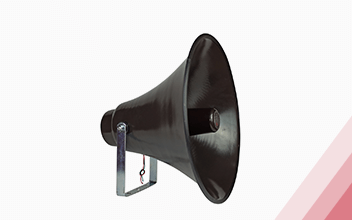
Early warning broadcasting equipment is based on 4G public network, providing users with multi-functional wireless early warning broadcasting services. High-fidelity power amplifier: strong, clear and bright sound quality, strong directivity, wide spread, even in a vast area, many obstacles in the environment, is still clear spread
Monitoring equipment
horn
 Monitoring elements

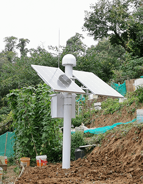
Working Principle
Horizontal and vertical monitoring is realized by satellite RTK differential technology with real-time accuracy of centimeter level and post-decompute accuracy of millimeter level.
Monitoring equipment
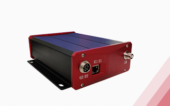

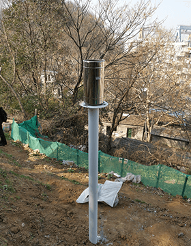
Working Principle
The rain barrel will receive the rainfall into a small bucket, after reaching a certain amount, it will be automatically poured out, and at the same time form the corresponding rainfall record, so that the rainfall process can be measured down.
Monitoring equipment


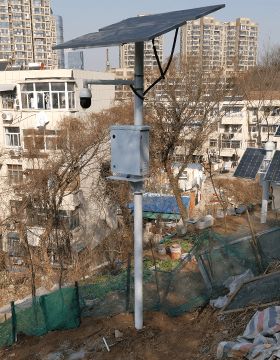
Working Principle
Through the application of video recording, playback, linkage alarm, monitoring strategy formulation and emergency command for remote monitoring objects, it achieves the dual functions of monitoring and communication, and fully meets the needs of remote monitoring and emergency command.
Monitoring equipment

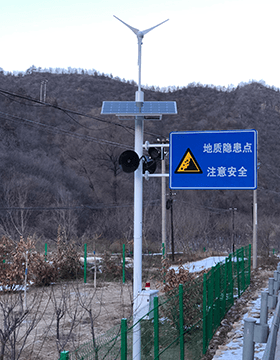
Working Principle
Linkage with the early warning function module of Kobo's geohazard monitoring cloud platform, sending out early warning signals through sound and light.
Monitoring equipment

 system platform

One Map Platform
A single chart synthesizes information from multiple monitoring programs
Monitoring risk analysis
Multi-source data collection and fusion technology, multi-means early warning analysis, customizable reporting services
Monitoring and early warning mobile
WeChat small program and mobile APP multi-channel display monitoring project
 Risk Analysis Functional Module
Fact Sheet
Monitoring the overall status of early warning in the region
GIS + 3D Visualization Integration
Beidou + geotechnical, meteorological and other multi-source sensor fusion
warning message
Red, yellow, orange and blue warning information
Comprehensive analysis of the causes of early warning
Leveled Alert Push
SMS, email and other push methods
data analysis
Trend analysis of Beidou, geotechnical monitoring data
Multi-source data correlation analysis
Improved tangent angle analysis
Stability assessment analysis of the monitoring area
Automatic generation of monitoring reports
Automatically generated by the system according to the settings
Daily, weekly, monthly and annual monitoring reports

 Short-range weather warning function module
 Short-range weather warning function model

High-precision three-dimensional water vapor inversion
Real-time high-precision inversion of three-dimensional water vapor content based on ground-based BeiDou.
Real-time dynamic monitoring of regional grid water vapor content.

short-range weather warning
High-time, high-resolution monitoring of temporal and spatial changes in atmospheric water vapor.
Regional grids for short-range weather forecasting can be realized.
 Project Cases
Tangjiahui Coal Mine Automated Surface Monitoring
Project BackgroundThe Tangjiahui mine is located in the central part of the Junggar Coal Field, and the terrain is generally high in the north and low in the south, with a general difference of about 80m in relative elevation. The coal mining area is located in the high loess slope, manual measurement and monitoring and its hard and difficult. The automated monitoring of the 61101 first mining face of Tangjiahui Coal Mine is the first use in the Inner Mongolia region, which was completed in June 2015.
Project location: Tangjiahui Coal Mine, Ordos City, Inner Mongolia Autonomous Region
Project cycle: June 2015-June 2018
Monitoring elements:: 1 GNSS reference station and 2 GNSS surface displacement monitoring stations.


Automated Monitoring System for Surface Movement and Coal Bunker Deformation in Coal Mines of Pan Yidong Mine
Project Background:Pan Yidong Shaft Field is located in Panji District, northwest of Huainan City, Anhui Province, about 13km southeast from Dongshan, center of Huainan City. the north is bounded by the F3 fault, the west is bounded by the No.Ⅲ exploration line, and both the east and south are up to the ground vertical projection line of the contour line of the bottom plate of the 13-1 coal seam-1000m; the mine has an average east-west strike length of nearly 8.0km, and an inclined width of about 4.5km in the north-south direction, with an area of about 36km2. pan Yidong Coal Mine The automated monitoring of the first mining face is the first use in the Huainan region.
Project Location:Pan Yidong Coal Mine, Huainan City, Anhui Province, China
Project cycle:March 2013-March 2015
Monitoring elements:12 BeiDou monitoring stations.
Anhui Banji Coal Mine Automated Monitoring of Airspace Zone
Project Background: The Banji coal mine shaft field is located at the border between Lixin County and Yingshang County, with a length of about 5.3 kilometers from east to west and a width of about 2.5 to 6.7 kilometers from north to south, covering an area of about 30 square kilometers. The area covered by the mining airspace is mostly residential houses and land crops, which has a close impact on the personal and property safety of the villagers. This project is to carry out automated monitoring of surface displacement in the operational airspace of the mining face to the west of the mine.
Project location: Huji Town, Lixin County, Bozhou City, Anhui Province, China
Project cycle: May 2021 to present
Monitoring elements:: 1 GNSS reference station, 8 GNSS surface displacement monitoring stations, 1 rainfall monitoring station

 Other solutions

