- copy")
Qucheng Tailings Storage Safety Monitoring and Early Warning Program goes live
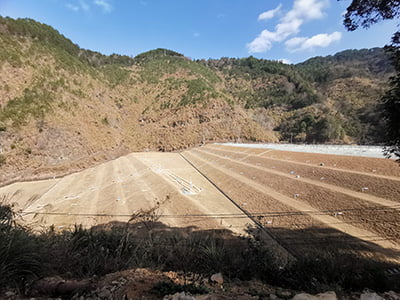
Dehua County Qucheng Mining Co., Ltd. designed tailings dam with a total height of 86m (including the initial dam of 30m, tailings accumulation dam of 56m), forming a total reservoir capacity of 5.8 million m³, set [...]
Mount Lushan Scenic Area Geological Hazard Monitoring Project
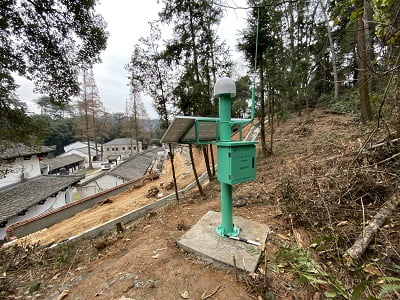
Mount Lushan scenic area of the mountain behind the White Deer Cave Academy loose soil structure, continuous heavy rainfall is very easy to trigger landslides and landslides. Serious threat to the lives and property of Mount Lushan residents and tourists [...]
Yunnan Power Grid Transmission Tower Attitude Monitoring System
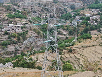
Yunnan 500KV Xiao Chu B line 075 and 076 tower transmission pole tower is located in Yunnan Dali Bai Autonomous Prefecture, located in remote villages, 075 tower in the pressure deformation and torsion [...]
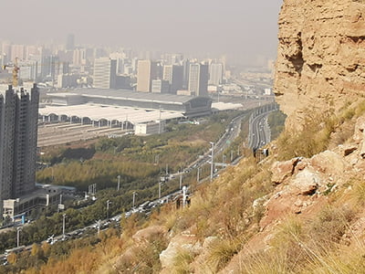
Geological Hazard Monitoring Project for Landslides on Nanchuan East Road, Xining City, China
Nanchuan East Road landslide group in Xining City, Nanshan west slope, the main hazards for the Nanchuan East Road, Nanyuan residential community, gas station, gas station and the bottom of the slope air-raid shelter, the threatened population [...]
Science and technology help Xining City Beishan Geological Hazard Monitoring Project
Xining Beishan landslide area of frequent geologic disasters, geologic disaster prevention and control difficulties, the landslide area is located in Xining Railway Station and residential neighborhoods on the north side of the serious hazards disasters affecting people's lives [...]
State Grid Transmission Line Tower Deformation Monitoring Project
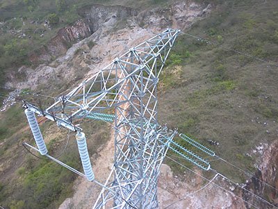
Hefei Chaohu City 220KV Temple Nest line 4847 35# tower is located in the landslide area, transmission line towers are prone to tilting, settling or falling under the influence of geological conditions [...]
Jingshan Landslide Geohazard Monitoring Project
Nanjing Lishui District belongs to Ningzhen-Yangyang hilly mountainous area, the low hills account for the total area of the district about 72.5%, and the hilly area of the Quaternary Upper Pleistocene Lower Shu Group powdery clay is widely distributed, [...].
Lancang River Lajin Shengu Landslide Monitoring Project
On July 14, 2019, invited by the Northwest Institute of China Electric Construction, the company set up the Lancangjiang Lajin Shengu Landslide Monitoring Project Project Team to go to Lajin Shengu Landslide to carry out emergency monitoring [...].
Cobalt Helps--Wuxi Xuelangshan Landslide Monitoring Project

The paragneiss slope on the east slope of Xuelang Mountain in Binhu District, Wuxi City, is a typical traction slope type prone to landslide geologic hazards, which is typical in the hilly area of southern Jiangsu Province. Snow [...]
Taicang City Yangtze River Dike Deformation Monitoring Project
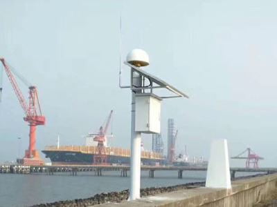
The Taicang section of the Yangtze River embankment is 38.8 kilometers long, protecting more than 900,000 people in Taicang as well as important towns and cities from flooding. However in recent years the main channel of the Taicang Yangtze River channel and the near [...]


 Su Gong Network Security No. 32011202000665